Your ground.Your data.Your call.
Drone maps of your fields, filed in a record you own. We fly it, your agronomist signs it, you keep it.
- The grower owns every file.
- A person signs every recommendation.
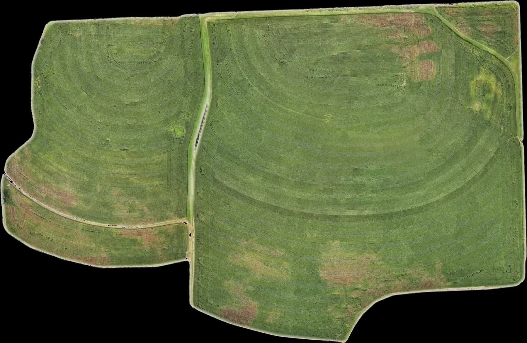
Behind: H-3, 65.3 acres, from our 6 Sep 2026 flight
The satellite shows a field.
Our flight shows the rows.
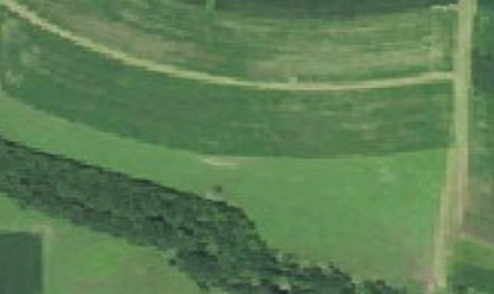
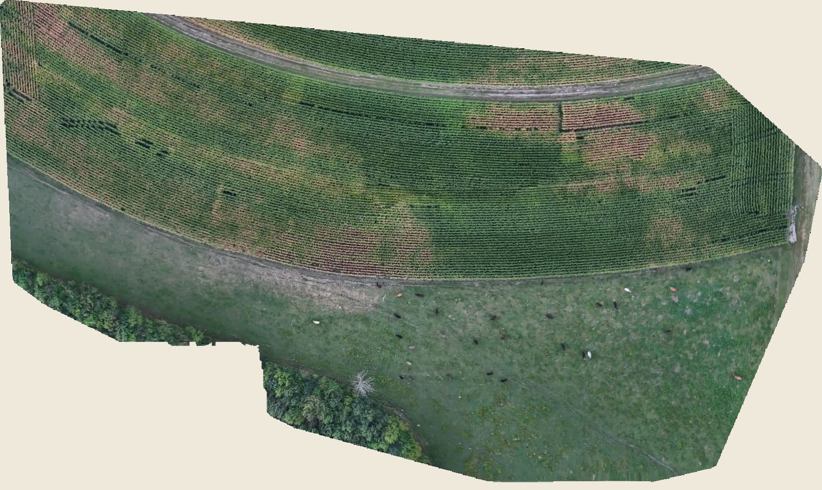
Right: the free satellite picture most farm apps use, about 60 cm a pixel. Left: our 2 September test flight over the southwest corner of H-3, 5 cm a pixel. Drag the handle.
USGS imagery for the satellite half · our map for the flight
01 · Fly
We fly it in the right light.
Wind, sun angle and shutter speed decide the day. The drone flies a lawnmower pattern and shoots a photo every 3 seconds. This flight: 620 photos in 38 minutes of flying, one battery swap.
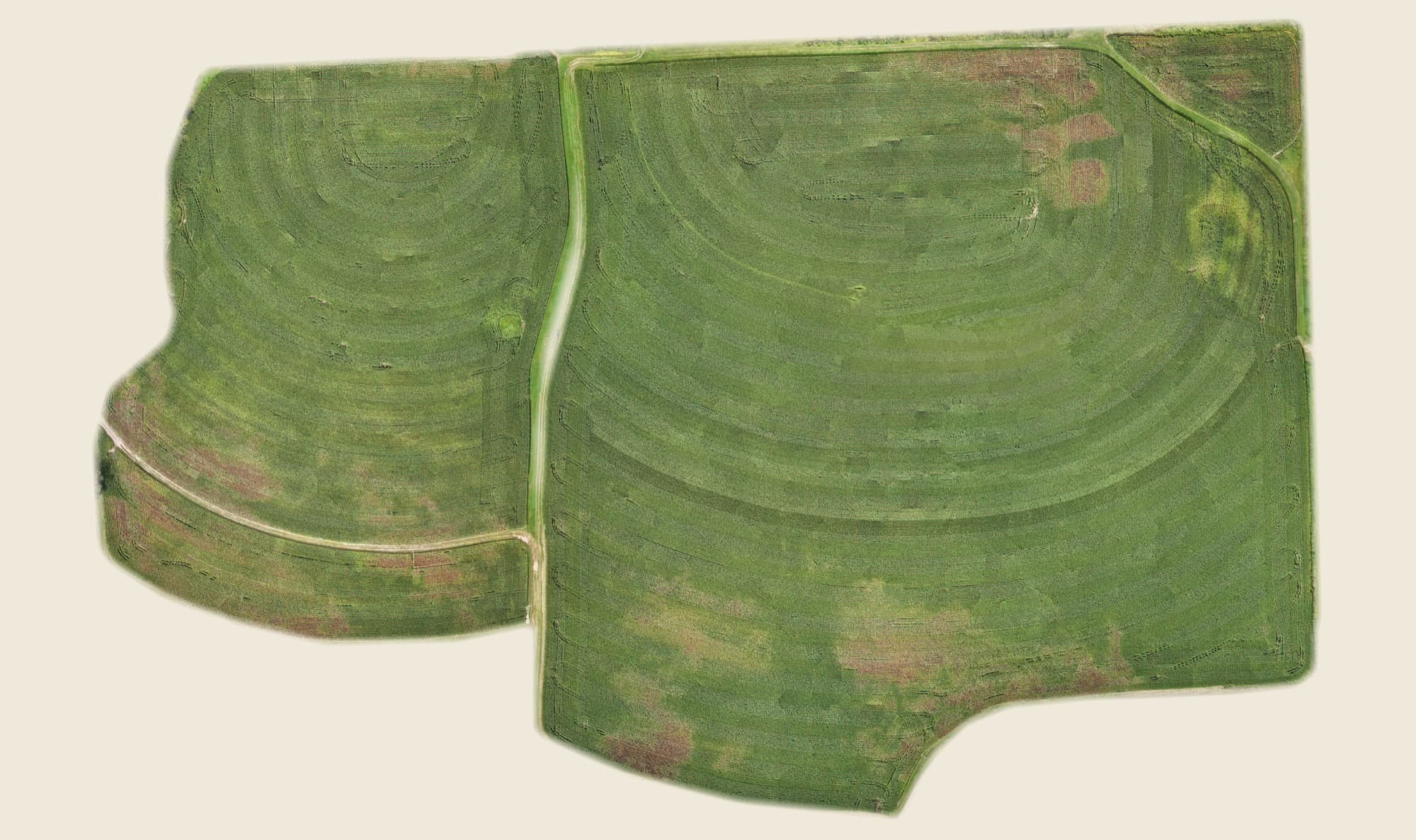
H-3 · Home Farm · filed
pH
6.2
in range
OM
2.4%
in range
P
34
high
K
115
in range
CEC
7.1
lighter
S
14
low
How a flight works
You name the field. We fly it and file it.
- 1
Text us a field.
Or your agronomist does. A field name and a reason is enough: stand check, gap map, drainage, a spray plan.
- 2
We fly RTK when it counts.
If a product needs centimetre accuracy, a spray boundary for one, we fly RTK and the record says so.
- 3
The files are yours to keep.
Stitched on our machine, filed to your field, opened from your link. Keep them or share them.
Priced per acre, one number, the map is yours to keep. Ask us for a quote.
Ask about a flightH-3 · Home Farm · 100 m up · 6 Sep 2026
- photosone every 3 seconds
- 0
- minutesin the air
- 0
- cm / pixelground resolution
- 0
- minutesto stitch
- 0
Acrefile
Every field’s records in one place, and they’re yours.
Every flight we make is filed in Acrefile, the field record you own: soil tests, tissue scans, maps and planter data, with your agronomist’s signed recommendation on top, and your own costs per field, budget beside actual. You sign in with your email; nobody else controls the account.
- Soil test in plain words
- Signed recommendations
- Machine data filed by location
- Cost of production per field
- One-page PDF
- Share links you can turn off
Recommendation · example
Potash where K runs low. Retest in three years.
— your agronomist signs here
pH
6.2
in range
OM
2.4%
in range
P
34
high
K
115
in range
CEC
7.1
lighter
S
14
low
The plat book
Every field on one page.
In Acrefile the farm opens on one map: every field outlined and tinted by farm, like the county plat book on the kitchen table. This is Sarauer Farms, drawn from the boundaries in its record. Tap a field and its record opens.
- H-2
- Home farm
- 38.9 ac
- H-3
- Home farm
- 65.3 ac
- J-1
- Justin
- 39.0 ac
- S-6
- Stanley's
- 7.3 ac
- 4 fields, 3 farms
- 150.5 ac
About
Two brothers,
one farm.
Badgair Bros started on the home farm outside Bloomer. One of us farms it. The other builds the tools and flies the drone. We built Acrefile because every report we got came in a different app, on someone else’s account, and none of it added up to a record of the ground.
Bloomer, Wisconsin